Monitoring rehabilitation using remote sensing in Jalainur District, China
Background of the thesis
Remote sensing – is a technology that enables evaluating and comparing the physical properties of objects based on their reflected and emitted radiance. When it comes to surface mining, the technology has found wide application over the last decades and is being actively researched and developed nowadays. Despite of the lower result accuracy and versatility compared to other research methods (drilling, sampling, laboratory analysis), remote sensing enables to acquire first results most quickly and on lowest expenditures. Moreover, some of the remote sensing applications are almost not possible by other methods.
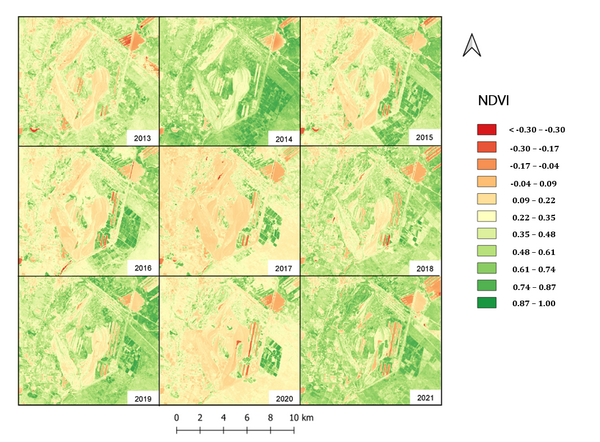
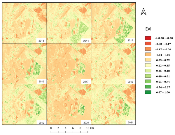
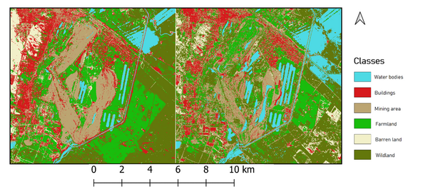
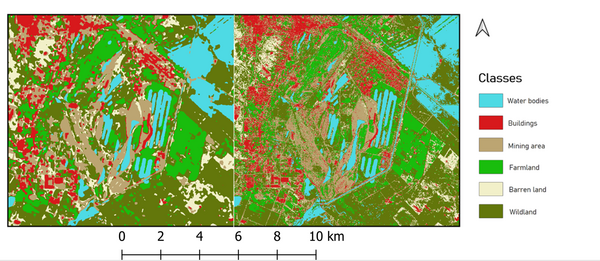
This paper will be covering the applications of remote sensing at the Jalainur mine – one of the biggest coal pits in north east China. Taking into account the considerable pit dimensions and the district population of more than 100 000 inhabitants living in close proximity to the pit, the rehabilitation is of high importance to the region. In the scope of this paper, change of vegetation condition over the last 9 years is evaluated by means of Normalized difference vegetation index (NDVI) and Enhanced Vegetation Index (EVI) vegetation index in order to qualitatively assess the rehabilitation progress. In addition to that, land use and land cover (LULC) classification based on deep learning (convolutional neural network) and machine learning methods is performed in order to track the land use change and quantitatively evaluate the reclamation progress.
Bearbeiter:
Nazarmukhammad Abdurakhimov
Betreuer:
Yu Lan and Prof. Dr. Jens-André Paffenholz
1. Gutachter und Betreuer:
Prof. Dr. Jens-André Paffenholz
2. Gutachter:
Prof. Dr. Oliver Langefeld (IBB)